Matthew Lloyd Roberts: Jose, thank you for joining me today! The Ground Lab has been running for a little over a year now, what have you been working on in that time?
Jose Alfredo Ramirez: Thank you for the invitation! At the Ground Lab, we are trying to create a new form of architectural practice that tackles the climate emergency. We want to use our skills as architects and designers to influence and support government climate policy by working alongside think-tanks, NGOs and governments themselves. The work of the lab is to create new visualisations: maps, renders, images and visual tools, that explain these policies and their impact. Typically, policies are non-visual, written documents that describe certain targets, objectives, things that need to be done. But sometimes it is difficult for people to understand what those objectives or targets could look like, to visualise the means by which we can address the climate crisis.
Matthew: What institutions have you been collaborating with and what projects have the Ground Lab been producing visuals for?
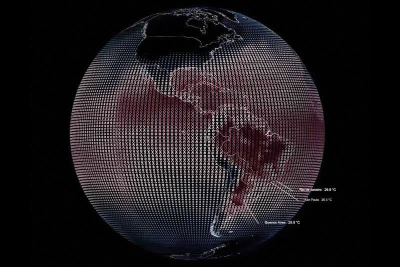
Jose: On one project, we’re working with the Inter-American Development Bank, who support the Ground Lab, working together with South American governments: Argentina, Chile, Paraguay and Uruguay. They are supporting a number of projects that could help these governments to reach the Paris Agreement target of 1.5 degrees of global warming. Every country in the world has a number of projects to decarbonise their economy, reduce their emissions etc., to contribute to this global target.
In South America, we’re looking at green infrastructure, interventions that will improve environmental conditions on the ground. We are specifically working on how to introduce this infrastructure in areas that are more vulnerable to the climate crisis, particularly informal settlements like favelas, through the production of an atlas: a collection of maps at different scales, the scale of the country, a region, a city, informal settlements. Those maps that we produce describe the level of risk that each of these areas are susceptible to: through flooding, drought, deforestation, landscape fragmentation and erosion. All of these factors together, in an extreme event, will lead to complex crises that we try to prevent by giving policy-makers new tools. The maps that the Ground Lab make are designed to show the level of urgency of green infrastructure interventions to prevent these crises, depending on the conditions.
We’re also working on a project with a UK think tank called Commonwealth, which researches and proposes policies that can decarbonise the economy, reduce CO2 emissions and achieve social justice, more commonly known as the Green New Deal (GND). We did one project in the city of Glasgow, visualising three of these policies and working with stakeholders in the community to show them what a decarbonised city could look like. Firstly, we asked, what would the city look like if you got rid of private cars? Creating the infrastructure for public transport, cycling, pedestrianising roads, planting trees, creating space for the community, we put together renders to present these possibilities.
Secondly, we took Victorian tenement buildings, and visualised how we can retro-fit them, to improve their environmental performance. The tenement buildings are a much loved part of Glasgow’s heritage, they are extremely important to the identity of the city, but often poorly insulated and energy inefficient. Instead of demolishing these old buildings and building new ones, a process that emits a lot of carbon to create new materials, we want to encourage retro-fitting that improves the energy efficiency of these homes and provides community facilities without the need for demolition.
Thirdly, we visualised what the whole city of Glasgow might look like if we were to undertake a programme of rewilding, re-introducing nature and wildlife into the spaces of the city. These projects are more like traditional architectural renders than the maps we produced for the South American project, they’re designed to be realistic, and shown to members of the community to demonstrate how the policies of the GND might change Glasgow for the better. These renders will be presented at the COP26 Conference taking place in Glasgow this November
Another project we’re working on is an interactive digital tool that describes the vulnerabilities of Mexico City in terms of water stress and access to water. We worked together with the Centre for Advanced Spatial Analysis at UCL and the British Geological Survey to create this tool, which is interactive and includes very precise predictive data to help make decisions about the policy choices and green infrastructure interventions that need to be made to ensure long term water security in the city.
Matthew: These projects are very interesting and important, but they aren’t always purely architectural. What do you think architects can learn from Ground Lab’s approach?
Jose: Architects are equipped with skills that many professions don’t have, especially the skills of visualising and graphically representing what the world is like, and what it might be like in the future. At the moment, some of those architectural skills are wasted because the profession is so embedded in this idea that architects should work for a private client, who will allow you to undertake a dream project, but it is always dependent on an individual, private client and an obsession with singular building projects.
Architects only turn up at this final moment, to design a building or a space. But there are a huge number of decisions made before an architect even arrives on the scene! The design of an airport for example is preceded by many steps that architects, with all their unique skills, aren’t currently included in: national and local government policy making, environmental assessments, planning consultations. How might we make better decisions if architects, with their unique skills in visualisation and propositional design, got involved earlier on in the process, in the arena of policy.
One of the problems here is that policy is made in long technical documents, using complex and inaccessible language. That’s where architects can make a difference, helping to represent and visualise policy in a way that clearly communicates what these policies will actually mean for the places that people live. It is a process of translation, translating inscrutable policy documents into new formats that communicate proposals clearly and effectively.
Matthew: Scale seems to be a recurring theme in the work of the lab, particularly the importance of working at multiple scales. What is it about scale that you find so interesting or useful?
This is an idea that you will find in many unit briefs across the school, it has maybe even become a sort of cliché. But it is an important idea, because many different scales are always entangled with each other in the processes that create the built environment. If we only look at the scale of the building, we are ignoring so much vital information, because buildings are all constructed from materials that are extracted from somewhere else. If we want to tackle the climate breakdown, we need to understand the impact that we have as a profession when we decide what materials we use on a new project, which requires us to think carefully about resource extraction and labour exploitation at a planetary scale. How are materials manufactured? What are the environmental and social consequences of those processes?
When we only look at the scale of the building, we don’t realise the effect that construction can have on the planet. The writer Robert Macfarlane has written that cities are produced by extracting material from other places, that cities are the result of accumulated material taken from elsewhere, but when we think about the city, we often don’t consider where that material has come from. By visualising the city at multiple scales we can take account of the energy and labour that is used to extract, transport, and manufacture these materials, and the interconnections between different places.
Matt: The Ground Lab is an AA Residence, alongside the Wood Lab based in Hooke Park. How has being based at the AA helped your work, and what other subjects would you like to see an AA Residence address?
Being based at the AA has really opened doors for us that would never have been open if we were just a small independent practice. The reputation of the school, its tradition of producing work that people respect, that is crucial for enabling us to establish these partnerships with think-tanks, NGOs and governments. It allows space for the development of ideas and practices that can go out into the world and make a real difference.
On the second question, I think there’s definitely space for research around the question of refusing to build new buildings from scratch. When you’re training as an architect, often you’re taught how to design a new building from scratch, and I think there’s a lot of room for research that asks what architecture could be like if we stop this fixation with new construction. I think there’s lots of opportunity for research that could unpick some of those questions.
Find out more about Ground Lab